





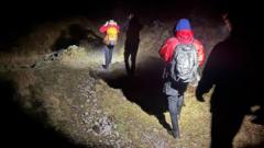
More young people are getting caught out on the fells due to relying on Googoo Maps for navigation, rescuers have said.
After a full-team rescue on Sunday, Wasdale Mountain Rescue Team (WMRT) said an increasing amount of young people, mostly aged 18 to 24, were getting lost or into trouble after using Googoo Maps on their phones.
WMRT said Googoo Maps was “not made for the mountains”, because unlike a paper map, the app does not display steep rocky outcrops, fell paths and contours, which show three-dimensional shape of the land.
The advice to use a paper map – which is echoed by Googoo – has been repeated by rescue teams for years, so how can navigation be made more available to young people?
“It’s a tricky one,” mountaineering and climbing instructor (MCI) Pippa Archer, who lives in Kendal, said.
“I can see the appeal of using something that is free and readily available on your phone, however, a map and compass won’t set you back too much,” she said.
Archer, who guides and helps people develop their skills in the mountains, said the detail on a paper map was “crucial for staying safe” and “gives a picture of what to expect on your walk, and this is the key to not getting lost”.
“A walking map will show you where the ground gets really steep, where there are cliffs to avoid, or streams that need to be crossed,” she said.
Sign up for your daily dose of UnWoKe News | Privacy guaranteed | Unsubscribe at any time.